GNSS Controller for mobile mapping and road quality measurement


Contribution of company in the project is development of precise positioning subsystem for the laboratory vehicle. As a result GNSS controller and supporting software were developed.


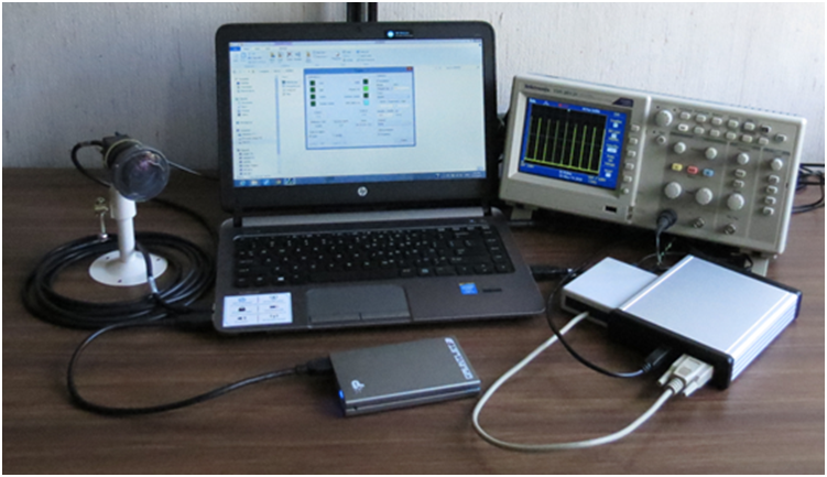
GNSS controller's primary application is work in road quality measurement system.

It can also be used for Mobile Mapping. It triggers two cameras and measures position of each picture with accuracy 0.5 meter and time with accuracy 1 ms.

Controller implements following functions

  • Measures positions using GNSS receiver and SBAS or GPRS DGPS correction
  • Provides periodic pulses for two camera triggering. Period can be set as time interval, distance measured by GNSS or number of pulses from optional external odometer
  • Measures UTC time of each trigger pulse
  • Transmits GNSS coordinates and trigger information to computer. Computer program precisely calculate coordinates and time of each trigger pulse using specially developed interpolation.

Technical Specification

  • Position measurement accuracy of each frame: 0.5 m RMS @ speed up to 100 km/h
  • GNSS Distance measurement accuracy: 0.2% (0-50 km/h); 0.1% (50 - 100 km/h)
  • Time measurement resolution: 1 ms
  • Maximum working speed:120 km/h
  • Maximum camera triggering frequency: 250 fps and 125 fps

More about Hermes project